Surveying by its definition deals with precision (points after the decimal place), accuracy (same measurement produces the same result - distance or angle) and math
There are many problems a non-surveyor can solve with this program and some
precise tape measure usage.
Below are samples of how a homeowner could work with his/her house and lot.
I would recommend a tape in feet and tenths if possible.
The main thing to remember is after you have two points then "You need to know two things to determine a third point"
Lets start by getting the point 1 & 2 - Point 1 is going to be at 5000 North and 5000 East
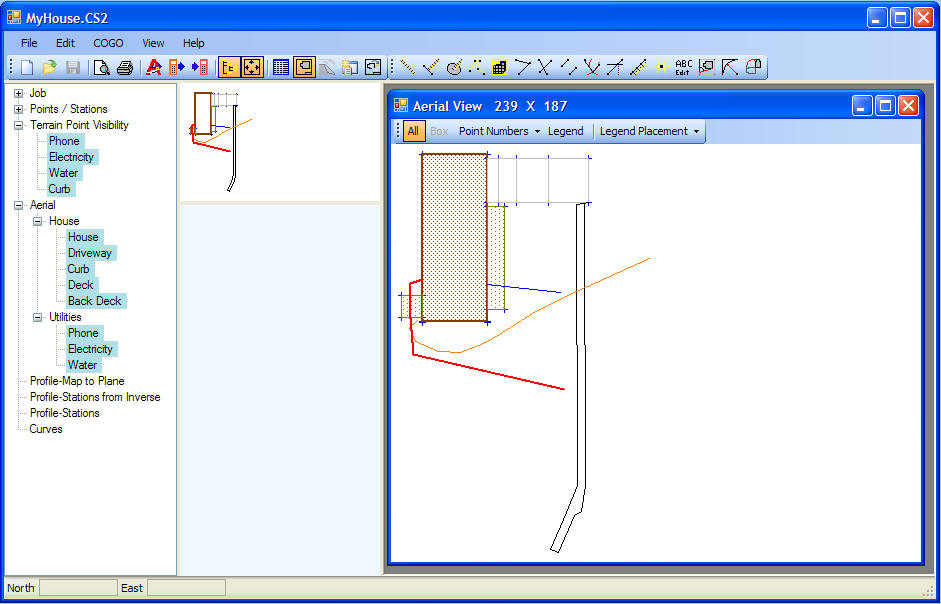
How ever you start this is the end result I have in mind - I used Feature Editor to define the lines and colors
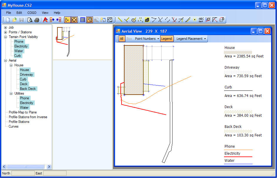
Same as above but with Legend turned on - showing you the color and hatch meanings back

Pictures of the phone line location
Possible uses